 |
Mapping
|
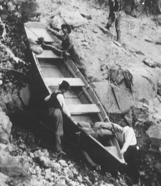
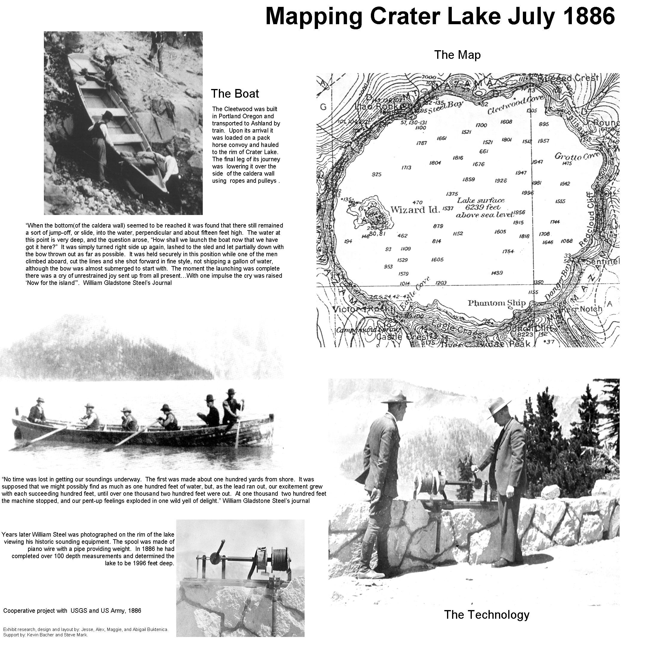
The Cleetwood was built in Portland Oregon and transported to Ashland by train. Upon its arrival it was loaded on a pack horse convoy and hauled to the rim of Crater Lake. The final leg of its journey was lowering it over the side of the caldera wall using ropes and pulleys.
"When the bottom (of the caldera wall) seemed to be reached it was found that there still remained a sort of jump-off, or slide, into the water, perpendicular and about fifteen feet high. The water at this point is very deep, and the question arose, "how shall we launch the boat now that we have got it here?" It was simply turned right side up again, lashed to the sled and let partially down with the bow thrown out as far as possible. It was held securely in this position while one of the men climbed aboard, cut the lines and she shot forward in fine style, not shipping a gallon of water, although the bow was almost submerged to start with. The moment the lauching was complete there was a cry of unrestrained joy sent up from all present...With one impulse the cry was raised 'Now for the island'". William Gladstone Steel's Journal.
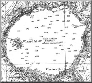
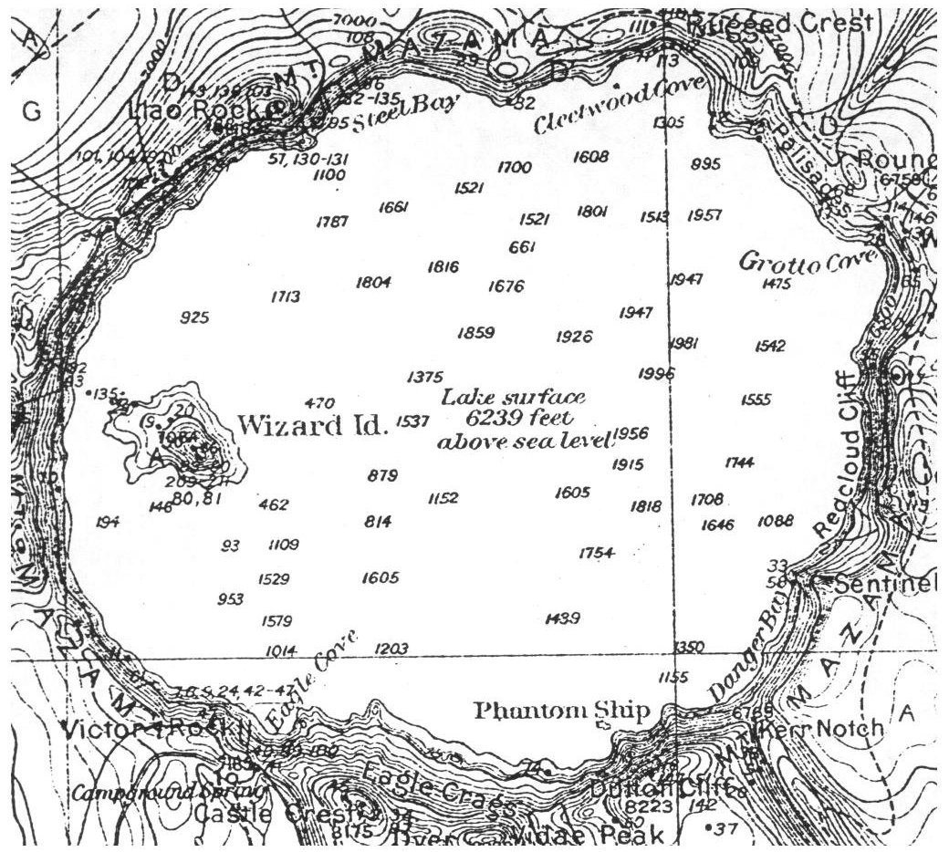
"No time was lost in getting our soundings underway. The first was made about one hundred yards from shore. It was supposed that we might possibly find as much as one hundred feet of water, but, as the lead ran out, our excitement grew with each succeeding hundred feet, until over one thousand two hundred feet were out. At one thousand two hundred feet the machine stopped, and our pent-up feelings exploded in one wild yell of delight." William Gladstone Steel's Journal.
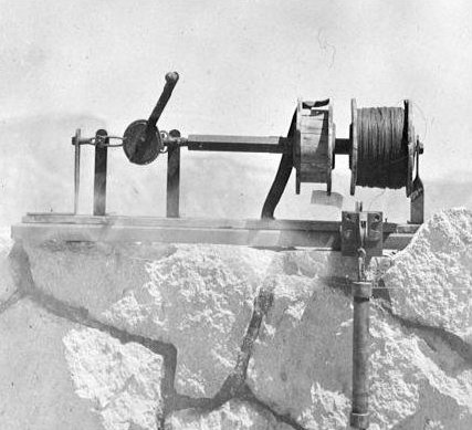
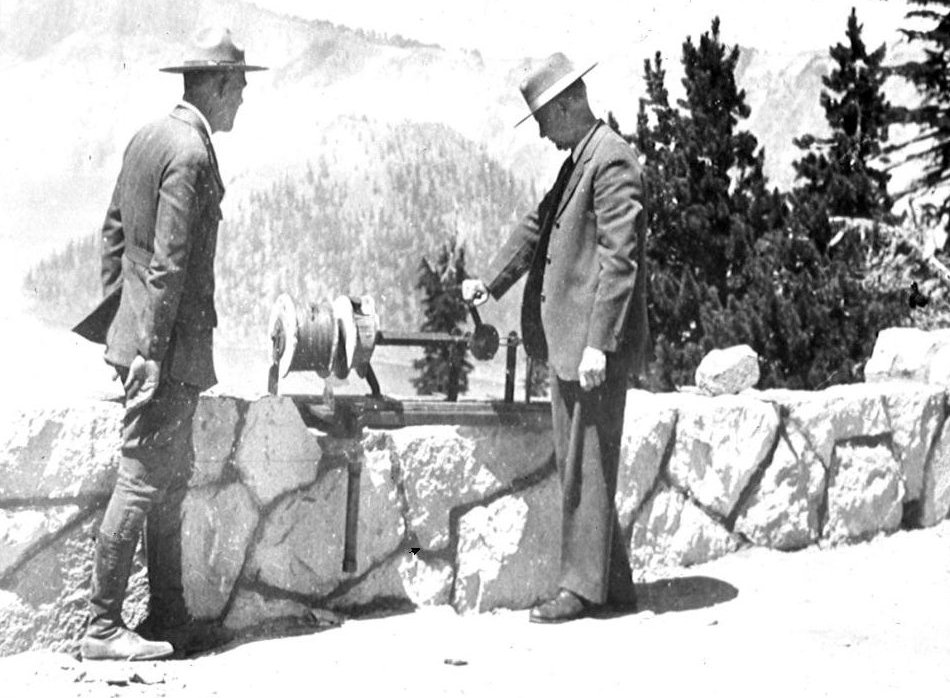
Years later William Steel was photographed on the rim of the lake viewing his historic sounding equipment. The spool was made of piano wire with a pipe providing weight. In 1886 he had completed over 100 depth measurements and determined the lake to be 1996 feet deep.
The Boat
|
The Map
|
The Technology
|

Cooperative project with USGS and US Army, 1886.
Exhibit research, design and layout by: Jesse, Alex, Maggie,
and Abigail Buktenica.
Support by: Kevin Bacher and Steve Mark.
Click here to view or right click to download the original layout of this information and photos: Mapping Crater Lake, July 1886 (864 KB JPEG file).