 |
Mapping
|
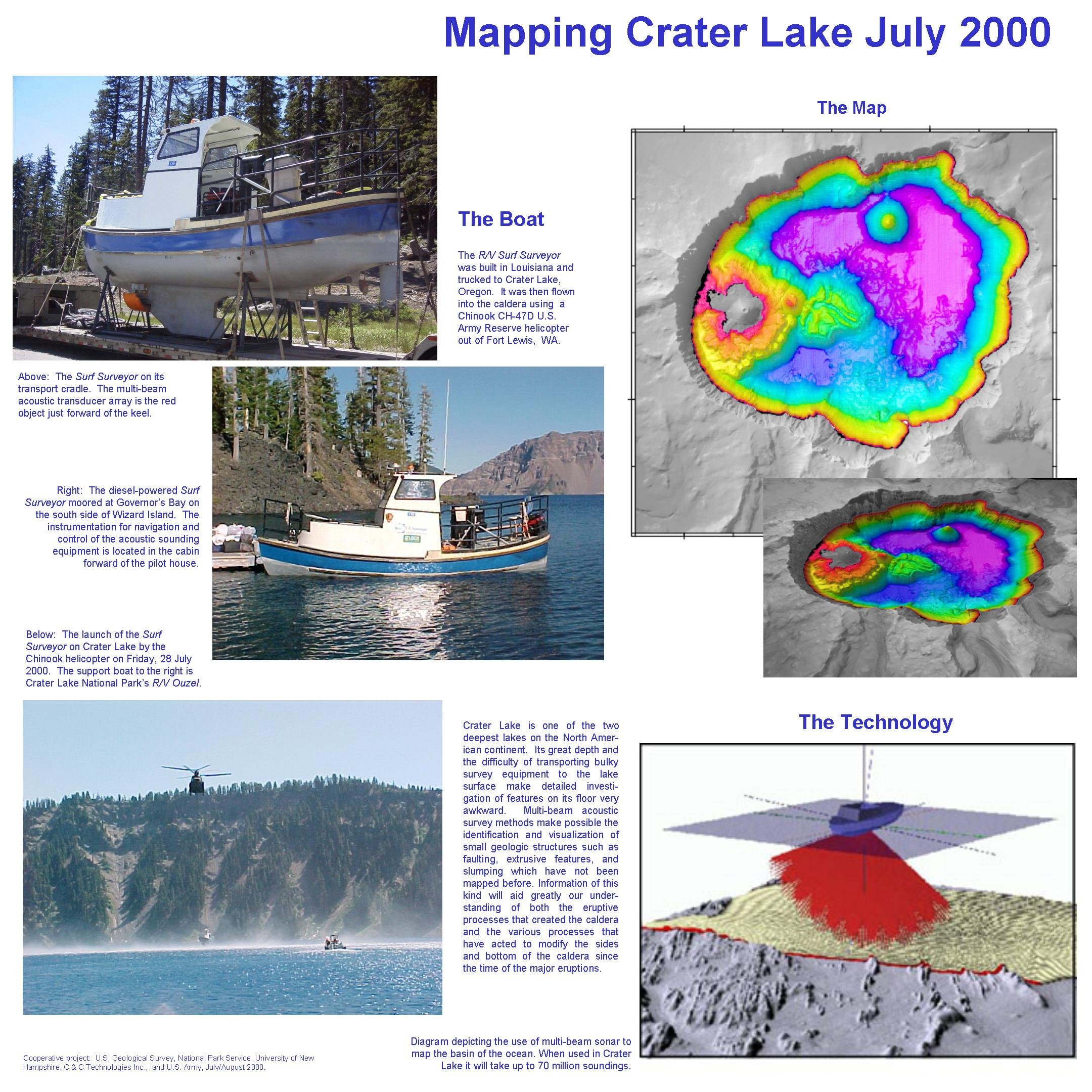
The Boat
The R/V Surf Surveyor was built in Louisiana and trucked to Crater Lake, Oregon. It was then flown into the caldera using a Chinook CH-47D U.S. Army Reserve helicopter out of Fort Lewis, WA.
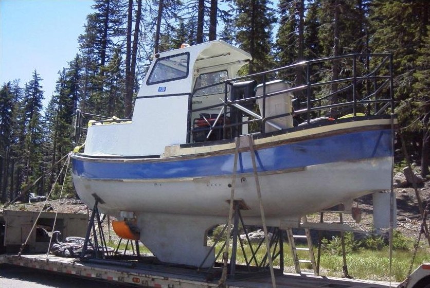 The Surf Surveyor on its transport cradle. The multi-beam acoustic transducer array is the red object just forward of the keel. |
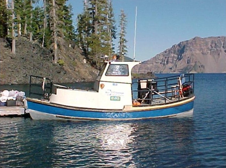 The diesel-powered Surf Surveyor moored at Governor's Bay on the south side of Wizard Island. The instrumentation for navigation and control of the acoustic sounding equipment is located in the cabin forward of the pilot house. |
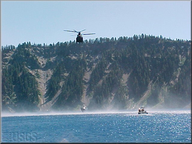 The launch of the Surf Surveyor on Crater Lake by the Chinook helicopter on Friday, 28 July 2000. The support boat to the right is Crater Lake National Park's R/V Ouzel. |
The Map and Technology
|
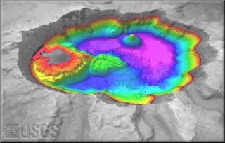
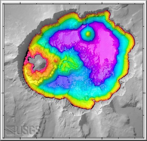
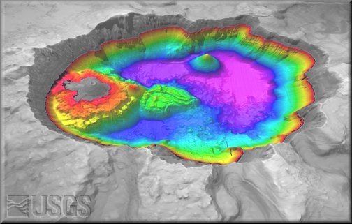
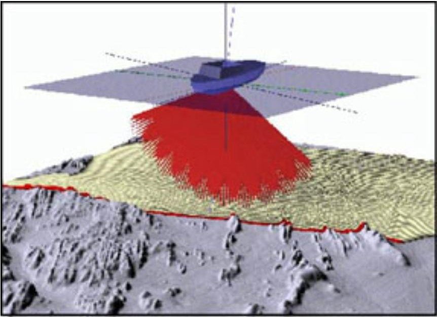
Crater Lake is one of the two deepest lakes on the North American continent. Its great depth and the difficulty of transporting bulky survey equipment to the lake surface make detailed investigation of features on its floor very awkward. Multi-beam acoustic survey methods make possible the identification and visualization of small geologic structures such as faulting, extrusive features, and slumping which have not been mapped before. Information of this kind will aid greatly our understanding of both the eruptive processes that created the caldera and the various processes that have acted to modify the sides and bottom of the caldera since the time of the major eruptions. Diagram depicting the use of multi-beam sonar to map the basin of the ocean. When used in Crater Lake it will take up to 70 million soundings. Cooperative project: U.S. Geological Survey, National Park Service, University of New Hamshire, C&C Technologies Inc., and U.S. Army, July/August 2000. Click here to view or right click to download the original layout of this information and photos: Mapping Crater Lake, July 2000 (800 KB JPEG file). |
|