 |
More on DLGs |
All DLGs distributed by the USGS are the DLG-Level 3 (DLG-3) category. DLG-3 data have a full range of attribute codes and full topological structuring, and have passed certain quality-control checks.
The 7.5- and 15-minute DLGs are within the large-scale category; the 2-arc-second DLGs are within the intermediate-scale, and the 1:2 million-scale DLGs are within the small-scale category.
Large Scale
Large-scale maps are produced in 7.5- by 7.5-minute units. They correspond to USGS 1:20,000-, 1:24,000-, and 1:25,000-scale topographic quadrangle maps. The unit sizes of 1:63,360-scale Alaska quadrangles vary depending on the latitudinal location of the unit.
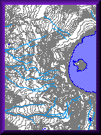
Large-scale DLG data contain nine categories of cartographic data in digital form: (1) Hypsography, (2) Hydrography, (3) Vegetative surface cover, (4) Non-vegetative features, (5) Boundaries, (6) Survey control and markers, (7) Transportation, (8) Manmade features, and (9) Public Land Survey System.
Extent of Coverage: DLGs produced from 1:24,000-scale topographic maps are available for the contiguous United States, Hawaii, and the Virgin Islands. DLGs produced from 1:25,000- and 1:63,360-scale are available for Alaska. DLGs produced from 1:30,000-scale are available for Puerto Rico.
Intermediate Scale
Intermediate-scale maps are produced in 30- by 30-minute units for the east half of the United States, and 30- by 60-minute for the west half. They correspond to USGS 1:100,000-scale topographic quadrangle maps. The 30-minute unit is produced and distributed as four 15- by 15-minute cells, except in high-density areas.
Intermediate-scale DLG data contain five categories of cartographic data in digital form: (1) Public Land Survey System, (2) Boundaries, (3) Transportation, (4) Hydrography, and (5) Hypsography.
Extent of Coverage: Intermediate-scale DLGs are available for the contiguous United States and Hawaii.
Small Scale
Small-scale maps are produced in 21 units (organized either by Section or by State); 15 units cover the contiguous United States, 5 units cover Alaska, and 1 unit covers Hawaii. They correspond to USGS 1:2 million-scale sectional maps of the 1970 National Atlas of the United States. The Section DLG data are historical files organized by sections of the United States (dating 1973-1980). The State DLG data are recent files organized by State (dating 1990-1994).
Small-scale DLG data contain five categories of cartographic data in digital form: (1) Boundaries, (2) Transportation, (3) Hydrography, (4) Manmade features, and (5) Public Land Survey System.
Extent of Coverage: Small-scale DLG data organized by State are available for the contiguous United States and Hawaii. Small-scale DLG data organized by Section available for all 50 states. Alaska is only available in the sectional format.
![]()
Note
A description of the cartographic data categories:
- Hypsography -- include contours and supplementary spot elevations.
- Hydrography -- include flowing water, standing water, and wetlands.
- Vegetative surface cover -- include information about vegetative surface cover (e.g., woods, scrub, orchards, and vineyards).
- Non-vegetative features -- include information about the natural surface of the Earth (e.g., lava and sand).
- Boundaries -- include state, county, city, and other National and State lands such as forests and parks.
- Survey control and markers.
- Transportation -- include (1) roads and trails, (2) railroads, and (3) pipelines, transmissions, and miscellaneous transportation features.
- Manmade features -- include miscellaneous cultural features such as schools, churches, hospitals.
- Public Land Survey System -- include township, range, and section information.