 |
DLGV 32 Viewer |
The dlgv32 viewer is a free downloadable software provided by the ![]() USGS Mid-Continent
Mapping Center (MCMC). The dlgv32 viewer is designed to preview cartographic
data sets, such as DLG, DRG, DEM, and DOQ. The viewer allows you to merge
and layer the data files.
USGS Mid-Continent
Mapping Center (MCMC). The dlgv32 viewer is designed to preview cartographic
data sets, such as DLG, DRG, DEM, and DOQ. The viewer allows you to merge
and layer the data files.
The dlgv32 is a data viewer program designed to preview the following cartographic data sets:
- Digital Line Graph optional format (DLG-O)
- Digital Line Graph SDTS (DLG/SDTS)
- GeoTIFF Digital Raster Graphic (DRG)
- GeoTIFF Digital Orthophoto Quadrangle (DOQ)
- GeoTIFF USGS Digital Elevation Model (DEM)
- Native format USGS Digital Elevation Model (DEM)
- GTOPO30 Digital Elevation Model (GTOPO30)
- Terrain Base Digital Elevation Model
- Digital Elevation Model SDTS (DEM/SDTS)
- Native keyword format USGS Digital Orthophoto Quadrangle (DOQ)
The dlgv32 viewer runs on Windows platform. Click on the following links to download the desired version of the dlgv32 viewer.
|
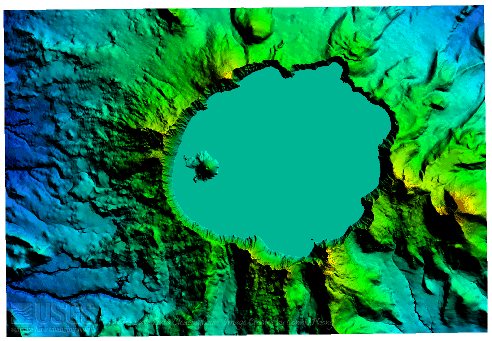
Unlike the dem3d viewer, the dlgv32 viewer allows you to merge and layer the data files. Following are some screen captures of DEMs, DLGs, and DRGs from the dlgv32 viewer. Click on image for larger image. |
DEMs of Crater Lake West and Crater Lake East. |
|
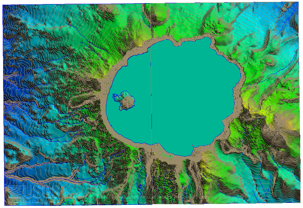
The hydrography and hypsography DLGs are draped over the DEMs. |
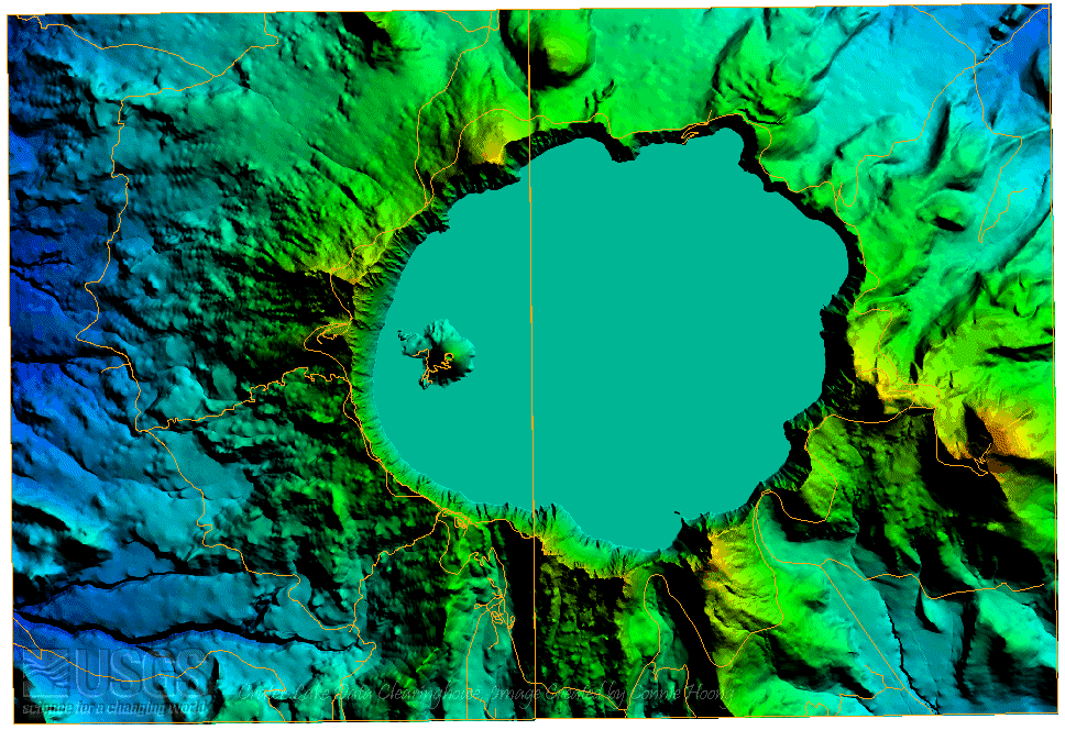
The road DLGs are draped over the DEMs. |
|
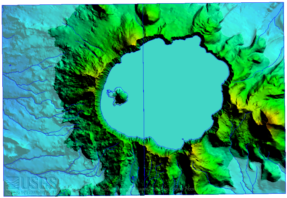
The program can raise and lower the water level. This DEM is flooded with water of 1900 meter (6235 feet). |
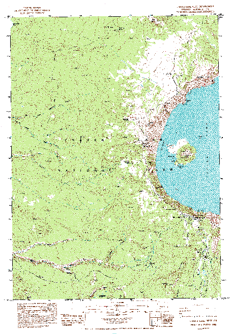
These two 7.5-minute DRGs on the left are brought up from TIFF images. Left is Crater Lake West and right is Crater Lake East. |