 |
More on DOQs |
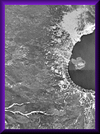
Standard DOQs produced by the USGS are in 1/4 pieces of 7.5-minute quadrangles, in black-and-white, or color infrared, at 1-meter ground resolution. The quarter-quadrangle image covers 3.75-minute of latitude by 3.75-minute of longitude, at a scale of 1:12,000 cast on the Universal Transverse Mercator (UTM) projection based on the North American Datum of 1983 (NAD83). The accuracy and quality meet the National Map Accuracy Standards at 1:12,000 scale for 3.75-minute quadrangles and at 1:24,000-scale for 7.5-minute quadrangles.
A DOQ may be used as a source or background layer in a geographic information system (GIS) to collect, review, and revise other digital data. DOQ can be combined with DEM and DRG to produce an image with additional visual information for the extraction and revision of base cartographic information.
Extent of Coverage: DOQs are available for the conterminous United States, Alaska, Hawaii, and Puerto Rico.
![]()
What is the difference between
an aerial photo and an orthophoto?
- A conventional perspective aerial photograph contains image displacements caused by the tilting of the camera and terrain relief (topography). It does not have a uniform scale. You cannot measure distances on an aerial photograph like you can on a map. Aerial photo is not a map.
- The effects of tilt and relief are removed from the aerial photograph by the rectification process to create an orthophoto.
- An orthophoto is a uniform-scale photograph. Orthophoto is a photographic map.
- Since an orthophoto has a uniform scale, it is possible to measure directly on it like other maps.
- An orthophoto may serve as a base map onto which other map information may be overlaid.