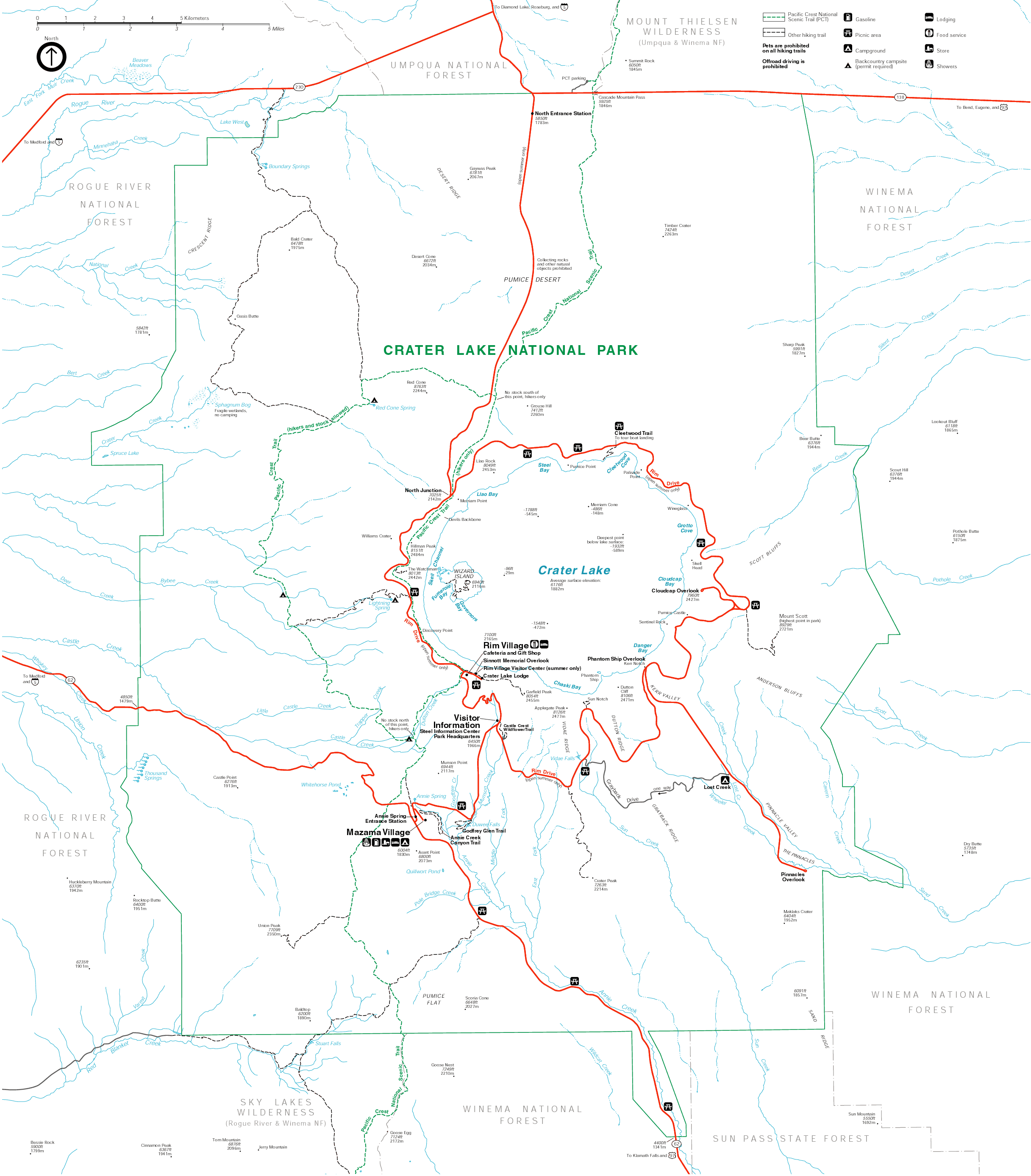
Road Map
Crater Lake National Park is located in southern Oregon.
|
Click on the road map (right) for a detail map of Crater Lake National Park. |
 |

Nearby cities and airports:
- Eugene, OR: airport is about 193 km (120 mi) northwest of the park.
- Klamath Falls, OR: airport is about 97 km (60 mi) south of the park.
- Medford, OR: airport is about 129 km (80 mi) southwest of the park.
List of distances from Crater Lake National Park:
- Bend, OR - 192 km (119 mi)
- Klamath Falls, OR - 92 km (57 mi)
- Lassen National Park, CA - 378 km (235 mi)
- Lava Beds National Monument, CA - 171 km (106 mi)
- Los Angeles - 1263 km (785 mi)
- Medford, OR - 124 km (77 mi)
- Oregon Caves National Monument, OR - 240 km (149 mi)
- Portland, OR - 402 km (250 mi)
- San Francisco, CA - 724 km (450 mi)
- Seattle, WA - 679 km (422 mi)
- Yosemite National Park, CA - 953 km (592 mi