 |
National Atlas of the United States |
The ![]() National Atlas of
the United States of America is a collaborative work established in
1997 by the U.S. Geological Survey and its Atlas Partners. The National
Atlas is designed to provide easy to use, map-like views of our natural
and socio-cultural landscapes for a better understanding of the complex
relationships between environments, places, and people.
National Atlas of
the United States of America is a collaborative work established in
1997 by the U.S. Geological Survey and its Atlas Partners. The National
Atlas is designed to provide easy to use, map-like views of our natural
and socio-cultural landscapes for a better understanding of the complex
relationships between environments, places, and people.
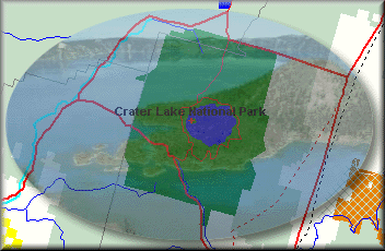
The National Atlas maintains a database of a number of coverages that might be useful. The National Atlas files have a scale of 1 to 2 million, so they are less accurate then the 1:24,000 scale data available on the Digital Line Graph page. However two files are useful for a general overview of the area around Crater Lake National Park: Federal Lands and Counties. These two files are available for download below.
Image of the flying eagle over the North America map is acquired from![]()
Data Download:
|
|
Federal Lands
( Counties
( |