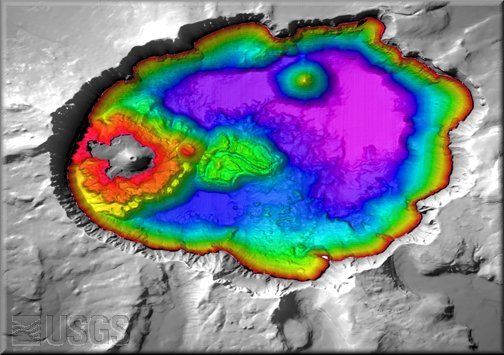
Map view of Crater Lake, OR. The colored region is shaded-relief bathymetry of the lake floor, generated from the new 6-m (20 ft) DTM; the gray region is shaded-relief of the surrounding land generated from a USGS 10-m (33 ft) DEM. Merriam Cone is in the upper center of the lake. Rhyodacite dome (red) and the central platform (green) are to the east (right) of Wizard Island. The distance across the lake is approximately 9.5-km (6 mi).