 |
Digital
|
A Digital Orthophoto Quadrangle (DOQ) is a digital, uniform-scale image created from aerial photos. It is a photographic map in which ground features are displayed in their true ground position, because relief displacements caused by the camera and terrain of an aerial photograph have been removed. It combines the image characteristics of a photograph with the geometric qualities of a map, thus it is possible to get direct measurements of distances, areas, angles, and positions from a DOQ.
Click here to learn more about DOQs.
![]()
DOQ Download
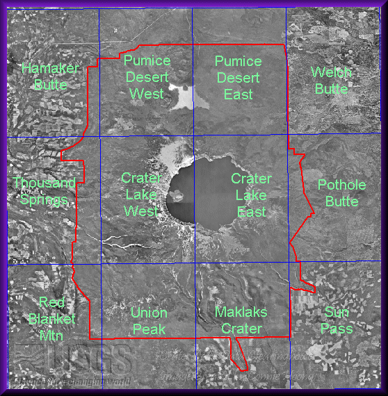
Crater Lake National Park covers twelve 7.5-minute quadrangle maps. The following quads were 7.5-minute DOQs created by the Forest Service (not quarter quad DOQs). These 12 DOQ quads have been mosaicked together with MrSID. The mosaicked files are more convenient for looking at areas throughout the basin or areas on the edge of two quadrangles.
|
DOQs are in UTM NAD83 zone 10 projection. Click on the following items to download:
|